British Isles Map Ancient
Skip to content
Explore
When autocomplete results are available use up and down arrows to review and enter to select. Touch device users, explore by touch or with swipe gestures.
Log in
Sign up
Explore
Travel
British isles map ancient
Discover Pinterest’s best ideas and inspiration for British isles map ancient. Get inspired and try out new things.
Last updated 1d
Related interests
Kingdoms Of Britain Map
Vintage Map Of British Empire
British Colony Map
Antique British Maps
British Tribes Map
See more
British isles map ancient and more
Explore related boards
Anglia
,
119 Pins
·
,
5y
Maps
,
833 Pins
·
,
2w
ECW
,
437 Pins
·
,
2mo
History
,
32 Pins
·
,
5y
Medieval family trees
,
53 Pins
·
,
4y
British Isles Map Colors
British Isles Map Printable
British Isles Map With Countries
British Isles Map With Cities
British Isles Geography
British Isles Geography Chart
British Isles Geography Map
British Isles Physical Map
British Isles Map Quiz
British Isles Map Colors
Map Of Britain And Ireland
Great Britain Map With Words
Uk Ireland Map Poster
British Isles Map Poster
British Isles Map With Landmarks
Uk Food Map
British Isles Map Illustration
Map Of British Isles
British Isles Map Art
Map Of Britain And Ireland
Anglo Saxon World Map
Anglo Saxon England Map
Anglo Saxon Map
Anglo-saxon English Regions
Map Of Anglo Saxon Britain
Map Of Anglo-saxon Wessex
Anglo-saxon Map Historical
Historical Analysis Of Anglo-saxon Expansion
1939 British Isles Atlas Map
Typepad | Network Solutions
17th Century Uk Geography
Historical Map Of Britain
Learn About Uk Historical Regions
Map Of The British Isles In 1645
Study British History Maps
Historical Map Great Britain
British Isles Fantasy Map
British Historical Map
Map Of Britain In 1900
17th Century Uk Geography
British Isles Geography
British Isles Geography Chart
British Isles Geography Map
British Isles Physical Map
Map Of British Isles Seas
British Isles - Physical Charts
British Isles Labeled
British Isles Historical Geography
Map Of British Isles
British Isles Geography
British Isles Map With Countries
Isle Of Coll Map Uk
Map Of Britain And Ireland With Countries
Map Of The United Kingdom And Ireland
British Isles Map Outline
British Isles Map With Cities
Map Of Great Britain And Ireland With Cities
British Isles Physical Map
British Isles Map With Landmarks
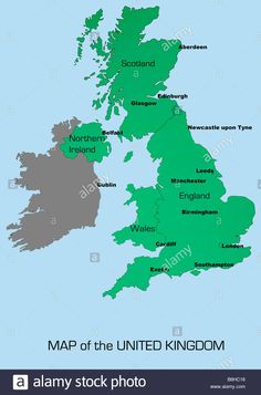
UK map outline showing England Scotland Wales and Northern Ireland with major cities Stock Photo - Alamy
Ancient Britain Map With Cities
British Isles Fantasy Map
Map Of Ancient Britain Kingdoms
Map Of Ancient Britain Provinces
Ancient Britain Historical Map
Historical Map Of Britain
Map Of Britain In Ancient Times
Historical Uk Map 7th Century
Map Of Early Medieval Britain
Map of the Island of Britain AD 450-600
Study British History Maps
Viking Map Of England
British Historical Map
Viking Heptarchy Map Of Uk
Historical Map Of Britain
Scotland Viking Era Map
British Isles Geography Chart
England Viking Invasion Map
Map Of Ancient British Kingdoms
Study British History Maps
Study Historical Language Maps
Map Of English Language
Historical Language Map
Map Of Britain In 1900
British And Irish Dialect Map
Uk Dialect Map
English Dialect Map
British Accent Map
1939 British Isles Atlas Map
Study Historical Language Maps
Ancient Britain Map With Cities
Viking Map Of England
Viking Age Map Of England
Map Of Ancient Britain Kingdoms
Map Of Ancient Britain Provinces
Ancient Britain Historical Map
Map Of Ancient Britain Regions
Celtic Britain Map
Map Of Britain In Ancient Times
Ancient Britain Map With Cities
British Isles Map Colors
British And Irish Maps
British Isles Geography Map
British Isles Physical Map
Isles Of Scilly Map Uk
British Isles Labeled
British Isles Historical Geography
Isle Of Wight Historical Map
Map Of British Isles
British Isles Map Colors
Vintage Map Of The Uk
Britain Map 1900
Britain Map 1800s
Vintage Map Of Britain
Map Of Great Britain Vintage
Map Of Great Britain 1900
Old Map Of Great Britain
Old British Maps
Antique British Maps
Vintage Map Of The Uk
Historical Language Map Scotland
Scots Dialect Map Regions
Scottish Dialect Map
Map Of Scots Dialects
Celtic Languages Map
Gaelic Tribes
Scots Language Map
Pictish Map Ancient Scotland
Shetland Isles Map Uk
Historical Language Map Scotland
British Accents Map
Map Of The British Isles
Map Of The Uk
Map Of Uk And Ireland
British Islands Map
Uk Map
British Isles Map With Countries
Great Britain Map
Uk Geography
British Accents Map
Uk Map 1922
1912 Uk Map
Map Of Britain In 1900
Britain Map 1900
Britain Map 1800s
Map Of Great Britain 1900
British Empire Map 1914
British Isles Lifeboat Map
British Empire Map 1912
1887 population map of the British Isles showing the relative density by counties
Uk Map 1600s
Britain To Norway Map Print
Old Map Of Great Britain
Old British Maps
Rare Map Of Britain
Old Britain Map
Antique England Geography
Antique Uk Historical Map
British Isles Map 1930s
Uk Map 1600s
Antique Map Decor
British Isles Historical Map
Educational Geography Resources
Home Office Wall Art Ideas
Vintage Map Of The British Isles
Uk Map Vintage Style
Vintage Map Of The Uk
Vintage Map Of Britain
Map Of The British Isles And Scotland
Antique Europe Maps & Atlases for sale | eBay
British Isles Elevation Map
Vintage Map Of Uk Coastline
British Isles Physical Map
British Isles Relief Map
British Isles Geology Map
Map Of British Isles Seas
British Isles - Physical Charts
British Isles Topographic Map
1939 British Isles Atlas Map
British Isles Elevation Map
British Isles Map
British Isles Map Outline
British Isles Map Printable
Map Of The British Isles
Outline Map Of The British Isles
British Isles Map Drawing
Uk And Ireland Outline
Uk Map
Outline Map Printouts: A-C - EnchantedLearning.com